Isett provides a full range of surveying services and has coordinated and integrated various survey types and field data collection methods in order to produce comprehensive mapping products for many large-scale projects. Our base plans are used by architects, developers, and municipalities, as well as commercial, industrial, and institutional clients for planning, site developments, and subdivisions. We can also field up to seven survey crews simultaneously.
Boundary Survey
This type of survey is made to establish or re-establish the outline of a parcel and to locate or set boundary monuments, as required for a variety of legal or development purposes. Isett’s surveyors research record information and perform precise measurements to allow them to accurately retrace property boundary lines. The plan produced from the survey includes information on the lot’s dimensions and acreage.
Topographic Survey
This survey shows existing natural and manmade features as well as elevations and contours. A Topographic Survey Plan, or Existing Features Plan, is typically used as a base plan for many kinds of development projects. The scope of projects Isett has provided topographic surveys for range from one acre to several hundred.
ALTA
Title insurance companies typically require this kind of standardized survey for commercial properties. The standards were developed by the American Land Title Association (ALTA) and the American Congress on Surveying and Mapping (ACSM).
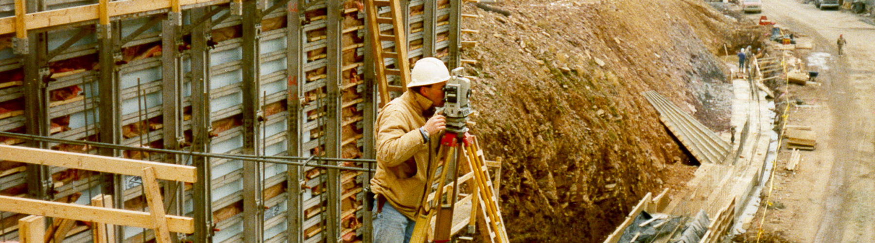
Construction
Isett survey crews use information on site plans to set reference stakes that show contractors the proposed location of site improvements. Various kinds of construction stakeout projects include buildings, utilities, roads, parking lots, sidewalks, and grading. Isett crews can perform rough or precise layouts — and can be on site whenever the contractor requires.
Utility
Accurate utility surveys are essential for engineering design. These surveys locate the visible portions of overhead and underground utilities and may include the marking of underground lines by Isett or an underground utility location subcontractor. Plans are prepared from this data as well as from record utility drawings.
Flood Elevation Survey
Project owners in areas at risk of flooding may benefit from having a Flood Elevation Survey so that the building’s elevation can be compared to the Base Flood Elevation (BFE) established on Federal Emergency Management Agency (FEMA) Flood Zone Maps. The resulting certificate details the elevations of various parts of the building as well as the lowest and highest property grading as compared to the BFE, key information in establishing insurance premium rates.
GPS/Geodetic Surveys
The Global Positioning System (GPS) is a global-navigation system formed from a constellation of 24 satellites and their ground stations. GPS, together with similar constellations administered by other countries and collectively recognized as Global Navigation Satellite Sytems (GNSS), can provide extremely fast and precise measurements over large distances. On large projects, GNSS technology gives surveyors the tools for an even higher degree of accuracy than traditional survey methods, while reducing the time and personnel required. The positioning accuracy of GPS can be as close as plus or minus one centimeter, depending upon the equipment and methods used. Isett utilizes the latest multi-constellation GNSS receivers to provide accurate location data for many survey projects.
Geographic Information Systems (GIS)
Geographic Information Systems (GIS) provide a means to capture, store and analyze spatial or geographic data. Utilizing a combination of conventional and GNSS measurements, Isett provides services to establish GIS databases for a variety of systems, including stormwater, sanitary sewer, and public water supply. Feature and asset data is collected and integrated with various base mapping products in order to allow clients to maintain and analyze their respective systems.
Contact us to get started today.